Google Earth just turned its trusted satellite maps into a playground for fake realities, and then slammed on the brakes.
Story Snapshot
- Google briefly let anyone lay AI-generated scenes over real satellite views inside Google Earth.
- Experts quickly showed violent and political fakes that looked like real map imagery and could spread online.
- After backlash over misinformation risks, Google rolled back the tool less than two days after launch.
- The episode raises deeper questions about whether Americans can still trust powerful tech platforms for basic facts.
Google Earth’s AI tool: what it did and how fast it was pulled
On July 30, Google turned on a new “create image” button in Google Earth on the web, powered by its Nano Banana 2 image generator. Users could zoom to any spot, click the button, and type what they wanted to see on top of real satellite, aerial, or 3D map data. Within hours, reporters and researchers showed how easy it was to generate fake buildings, disasters, or war scenes sitting on real-world coordinates. Less than 48 hours after launch, Google announced it was pausing the feature to add “stronger guardrails.”
The company stressed that the synthetic images did not appear in the main live map and were marked as AI-generated inside projects. But once a user downloaded or screenshotted an image, it could move onto social media without clear warning labels. That quick reversal — from global rollout to shutdown in under two days — shows how even giant tech firms are still underestimating how fast bad actors can weaponize new tools. It also underlines how fragile public trust in basic information systems has become.
Why researchers say this threatens trust in satellite imagery
Satellite and aerial imagery have become a key way that journalists, researchers, and everyday citizens double-check what governments and corporations claim. Open-source investigators use services like Google Earth to verify if a factory exists, if a border camp is real, or if war damage matches official reports. By putting a simple text box inside that same tool and letting users “type whatever you want to see,” Google effectively blended documentary-style maps with made-up scenes. Experts warn this blurs the line between evidence and fantasy in a space people rely on for hard facts.
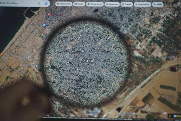
Investigators quickly proved the danger. One researcher generated fake scenes like “refugees near the Mexican border” and a bomb crater near a hospital in Gaza, all placed on real map locations. Another showed how easy it was to “plant” a nuclear facility in Iran with a prompt. These images looked like normal satellite views at first glance, complete with realistic lighting and shadows. When such images are shared during a crisis, many viewers will never know they are synthetic. That risk plays directly into fears on both the right and left that powerful tools are making it even harder to tell what is real.
Google’s guardrails: watermarks, hidden checks, and their limits
Faced with growing criticism, Google pointed to its SynthID system, an invisible watermark baked into every image created with Nano Banana. The company said anyone unsure about an image could ask the Gemini chatbot or use the Lens feature in search to see if the picture was AI-generated. In theory, that means investigators and platforms have a way to detect fakes and label them properly. In practice, it puts the burden on the public to do extra work, and it assumes they trust Google’s own tools to verify Google’s own content.
Google also noted that the AI images lived inside private projects and did not overwrite the main map. But from a public trust angle, that misses the point. Once a screenshot leaves Google Earth, it can travel anywhere without context, and millions of users will only see “a satellite image from Google.” For conservatives already angry about “fake news,” deep-state narratives, and censorship, this looks like another way elites can bend reality. For liberals worried about propaganda, human rights abuses, and disinformation, it looks like a gift to bad actors who want to cover their tracks or spark panic.
What this reveals about the broader failure of big tech and government
This Google Earth episode hits a nerve because it sits on top of a wider failure of institutions to protect basic truth. Many Americans now feel the federal government, big tech companies, and media elites are more focused on power and profit than on helping people navigate real-world problems. Here, a company that markets itself as a source of trusted maps decided to let anyone create photorealistic fakes based on those same maps, then only backed off after public outrage. That sequence feeds the belief that leaders act responsibly only when caught.
What breaks when AI can fake any place on Earth?
The issue was not that Google Earth could generate fake images. It was that it could make fake images inherit Google Earth’s authority in 24 hours.
On July 30, Google launched Nano Banana 2 inside Earth: select any coordinates,…
— Nox Vector (@NoxVectorAI) July 31, 2026
The controversy also shows how generative AI is moving inside tools people use every day, not just in art apps or fun filters. When synthetic media sits next to what looks like “ground truth,” the risk is not only lies, but confusion and fatigue. Regular people begin to wonder if anything they see can be trusted, whether it is an image of a protest, damage from a storm, or activity at a military base. That growing doubt does not hurt elites first. It hurts the citizens who need solid information to hold those elites — in government, corporations, or tech — accountable.
Sources:
theatlantic.com, blog.google, developers.google.com, mashable.com, android.com.pl, explainx.ai, lifehacker.com
© totalconservative.com 2026. All rights reserved.